A Glacial Story

Several year ago, on a whim, I decided to make a side trip to Glacier National Park to try to catch the fall leaves changing. No plan, no overall photography strategy, just felt the urge to go see the place. I was inspired to see Glacier NP after seeing the series Ken Burns did on the National Parks. So, if not then, when? Gayla thought I was nuts, but that isn’t the first time! 🙂

Although unfamiliar with the park, I looked at the map and made the choice to start at Swiftcurrent Lake on the north side of the park, entering from the east. The plan was to get there before sunrise to see the mountains light up as the sun broke the horizon. The lake is near the trailhead that leads up to Grinnell Glacier. Just below the glacier is Upper Grinnell Lake, which the trail leads to, a great photo location. The trail goes up a gorgeous valley with spectacular waterfalls. The plan was to take the 10-mile round trip hike up to the lake for a great view of the glacier and valley scenery. That was the plan anyway.

It was late in the season for Glacier NP, and the Many Glacier part of the park was closing down for the winter. That was nice because there weren’t many people around. As I drove into the park at “O Dark Thirty”, two bear ran out in front of me on the road in, crossed the bridge and disappeared off into the brush. They were probably going to visit the 6-8 other bear I saw running around that morning. Either way, my desire to explore the amazing beauty laid out in front of me was quickly overtaken by the desire to enjoy lunch, not BE lunch!

It was an amazing morning! The scenery is fabulous and what a gift to be able to experience this spectacular park. But, I realized I wanted to know more about the place, so I dove in and did a little research on the geologic history of the area. Here is what I found.
A beach picture? Yes, if we were here over 1.5 billion years ago, this is what the place would have looked like. Shallow seas, stromatolites were likely representative of the simple life forms that existed then. A Walk Across Time as well as Western Wyoming Rocks gives some background on what life was like then. We have much to thank our little Stromatolite friends for, they helped give us oxygen to breathe. This algae goes through life consuming carbon dioxide (CO2) from seawater and, in turn, giving off oxygen in the trade. They created the oxygen-rich atmosphere that made life for the rest of us possible. Quite nice of them, I say.

They also did something else, they were responsible for making the calcium carbonate that settled on the sea bottom turning into limestone and dolomite that made all those rocks we see. Thousands of feet of rocks!! Almost all the rocks we see in the photo below were sediments deposited in shallow seas well over a billion years ago. The Glacier NP website does a great job of explaining this.
There is one exception to the layers of rocks that was not deposited at the bottom of the sea. The youngster in the crowd decided to insert itself about 750 million years ago. If you notice the horizontal racing stripe to the left of Grinnell Glacier, that is the Purcell Sill. The dark stripe in the middle is a rock-type called “diorite”, fancy name for granite with not as much of the mineral silica as granite. This rock came up from a magma pool below but rather than reaching the surface and “extruding” on the ground, it flowed up and “intruded” between the rock layers and cooled below ground. The white layers above and below the dark layer are marble. They started as limestone but when the hot magma intruded, it “cooked” the limestone into becoming marble. That’s how marble is made. Since the intrusion horizontal, they call it a “sill”, if the intrusion were more vertical, they would call it a “dike.” 🙂

This was all well and good until about 150 million years ago when the North American continental plate started colliding with the Farallon plate in the Pacific. To make it simple, it was a bit like a pickup truck being rear-ended and shoved up on top of the Pinto sitting in front of it at the traffic light. The wheels of the truck started below the roof of the Pinto but ended up above the roof of the Pinto. You get the idea!

Geologically, this is what happened. All the rocks we see in the pictures above were thrust up and over the younger “Cretaceous” rocks and are almost a billion years older than the rocks they are sitting on. Very rare to find this arrangement since normally the older rocks are on the bottom of the stack. These older rocks were “bumped” at about a half-inch per year and over a 90 million year time span, were transplanted about 50 miles east.

Without that collision, we wouldn’t see the rocks we do today.

For many years after the collision, erosion peeled off the younger rocks that were on top of the rocks we see but the master sculptor didn’t get to work until around 2.6 billion years ago. The Pleistocene Epoch (Ice Ages) brought the glaciers which carved these classic U-shaped valleys we now see. For over 2 million years, glaciers came and went. The beginning of the Holocene Epoch starting around 11,000 years ago which ended the last “glacial maximum.” All the glaciers from the Pleistocene Epoch melted. But, you ask, what about the glaciers we see today in the park? Temperatures since the last major ice age ended continued to fluctuate, as they normally do in nature. The glaciers we see today were likely formed around 6,000 years ago and have grown and receded several times since then. The “Little Ice Age” was likely a time of glacial growth but as we started warming up again in the 1800’s, they recession cycle began.

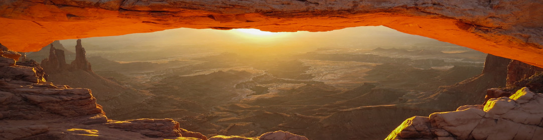
Had we been passing through the area in the early 1800’s when Lewis & Clark led the “Corps of Discovery” we would have found this area to be rough passage. The “Going to the Sun” road makes this journey quite enjoyable.
I still have that hike to Upper Grinnell Lake on the bucket list. The fall is a beautiful time to visit!!

Thanks for reading. I’d love to hear your thoughts!!
Leave a Reply